About the Ginninderra Catchment
Ginninderra Creek is of major importance in both a local and regional context. It carries approximately one quarter of the urban water runoff from Canberra directly into the Murrumbidgee River system and then the Murray. Hence there is considerable potential to degrade the already stressed aquatic ecosystems of the Murray-Darling Basin.
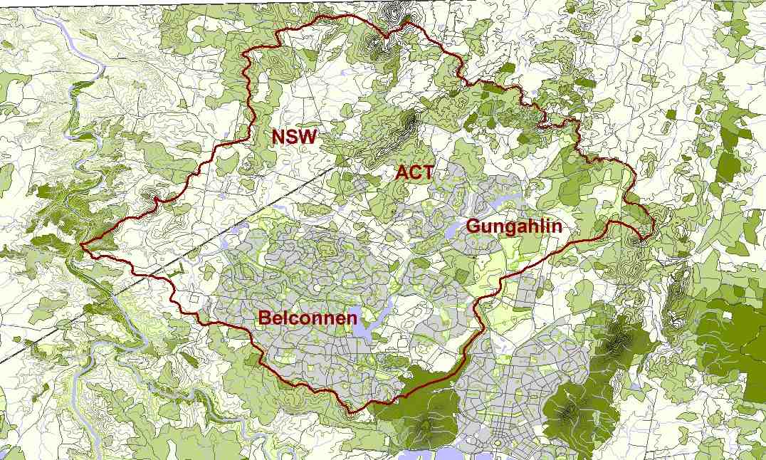
Ginninderra Creek itself begins in the upper reaches of Gungahlin within the Mulligans Flat Nature Reserve and enters the Murrumbidgee at Ginninderra Falls in Parkwood. The water catchment for the creek and its tributaries crosses the border between the ACT and NSW and takes in some 32,000 hectares of land.
The Ginninderra Catchment

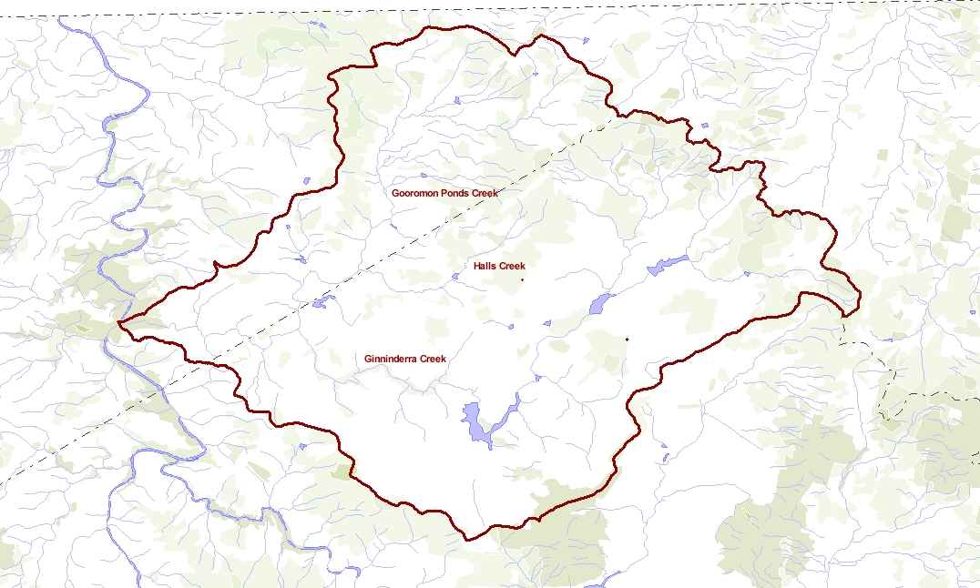
There are various land uses within the catchment including: urban, rural, rural residential, nature reserve and areas zoned for further development. The named tributaries of the catchment are Ginninderra Creek, Gooromon Ponds Creek, Gold Creek, Gungaderra Creek, Cow Flat Creek, Halls Creek and Bedulluck Creek.
The area can be roughly broken down into three areas:
1) Land above 600m (steeper slopes). Major land uses include nature reserves and broad acre rural.
2) Mid creek basins 600 – 500 m (undulating to flat slopes). Major land use includes suburbs, developing urban, rural residential, urban open space and some broad acre farming.
3) The Ginninderra Creek Gorge and the Murrumbidgee River Corridor. Major land uses include broad acre farming and a private nature park.
What is a catchment?
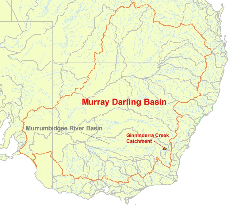
A catchment is a series of connected landscapes that collectively surround a river or creek system and direct water (via rainfall) to that river or creek system via surface and sub-surface flows. Catchments can be very large, like the Murray Darling Basin (which is in effect a connected series of catchments; including for example, the Murrumbidgee catchment). Catchments can be more moderate in size like the Ginninderra catchment.
Catchments can also be small and often called sub-catchments, like those that surround the tributary creeks that flow to Ginninderra creek.
The Murray Darling Basin, and the Ginninderra Catchment
What is catchment management?
Catchment management can be defined as the coordinated and sustainable use and management of land, water, vegetation and other natural resources on a water catchment basis so as to balance resource utilisation and conservation. Catchment management is informed by the principles of Ecologically Sustainable Development (ESD) which give priority to the, “use, conservation and enhancement of community resources so that ecological processes on which life depends are maintained and restored and the quality of life, now and in the future can be increased”.
The water quality of Ginninderra Creek is of importance to many of Canberra residence because it is a major tributary for the Gungahlin Ponds and Lake Ginninderra. These two lakes form focal geographical, scenic and recreational sites for the established town centre of Belconnen and the fast growing regional centre of Gungahlin.
Canberra is Australia’s largest inland city and it lies within the catchment of the Murrumbidgee River. It therefore follows that there is great potential for Canberra to degrade the already stressed aquatic ecosystems of the Murray-Darling Basin. Hence Ginninderra Creek is also of major importance in this regional context as it carries approximately one quarter of the urban run off from Canberra directly into the Murrumbidgee River system.
Major Drainage Lines and Topography of the Ginninderra Catchment

Find out more about the Ginninderra Catchment
Go to Our Catchment History to discover the landscape history of the Ginninderra Catchment.

